

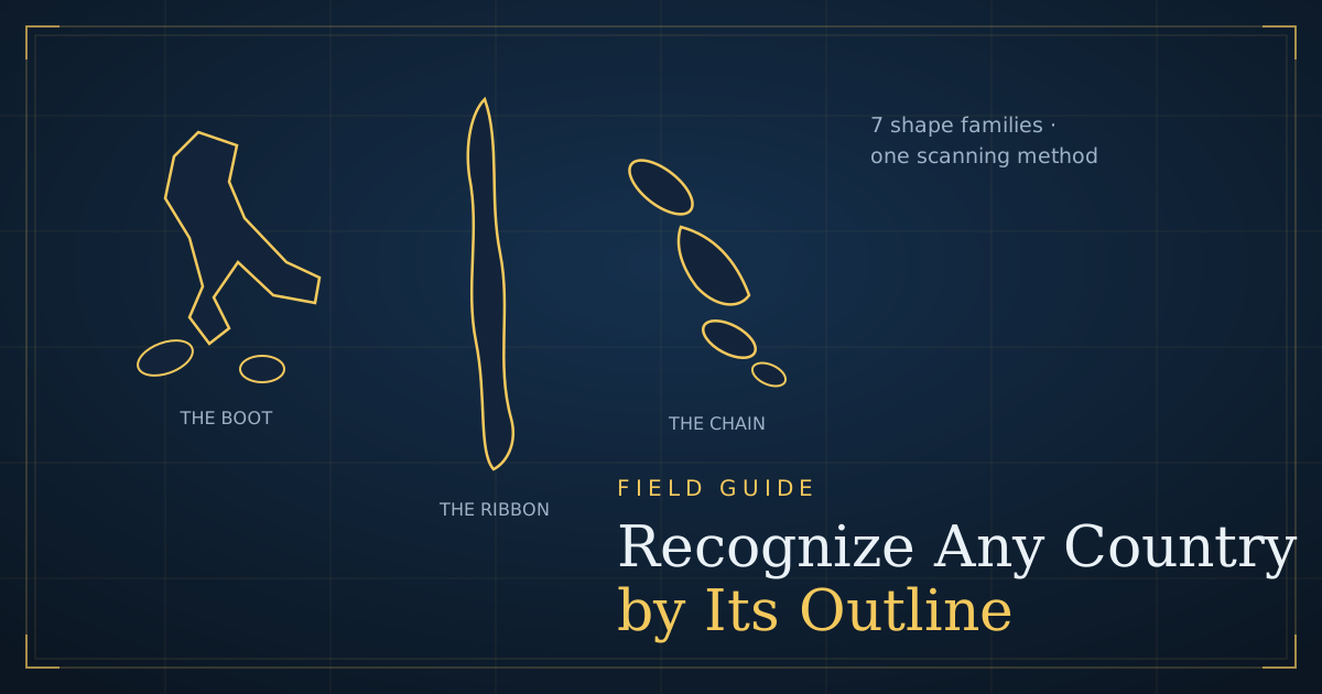
Show someone the outline of Italy and they name it instantly. Show them Paraguay and you get a long silence. The difference is not talent — it is that Italy’s boot has been drilled into all of us since childhood, while Paraguay has not. Outline recognition is a learnable pattern-matching skill, and like all pattern matching it collapses from “impossible” to “obvious” once you know which features to look at and in which order.
This field guide teaches the system: a three-second scanning method, seven shape families that cover every outline you will ever meet, the lookalike pairs that cause most wrong answers, and a four-week plan that turns all of it into reflex. What you’ll learn:
- The three features experts scan first (and why order matters)
- The 7 shape families — from boots to fractal coasts — with examples of each
- The most commonly confused outline pairs, and the single tell for each
- A ten-minutes-a-day drill plan built around Silhouette mode
Why outlines are learnable at all
A country’s outline is one of the most stable visual signatures in geography: borders change rarely, and the distinctive features — peninsulas, islands, straight colonial edges — survive at any map scale. That stability is why the skill transfers: learn a shape once and it works in every quiz, every atlas, every Worldle-style game, at every zoom level.
There is also less to learn than you might fear. Of the roughly 195 widely recognised countries, a few dozen are instantly identifiable anchors (nobody forgets Australia), and the rest cluster into a small number of recurring silhouette types. You are not memorising 195 arbitrary squiggles; you are learning seven families plus a modest set of exceptions — a very different task for your memory.
One warning before the method: size is a trap. Quiz silhouettes are shown at whatever scale fills the card, so a 2 km² microstate and Russia occupy the same box. Every technique below works on shape, never on size.
The three-second scan
When a silhouette appears, untrained players stare at the middle of the shape and wait for inspiration. Trained players run a fixed scan — proportions, then coastline, then borders and islands — because those three features carry almost all of the identifying information.
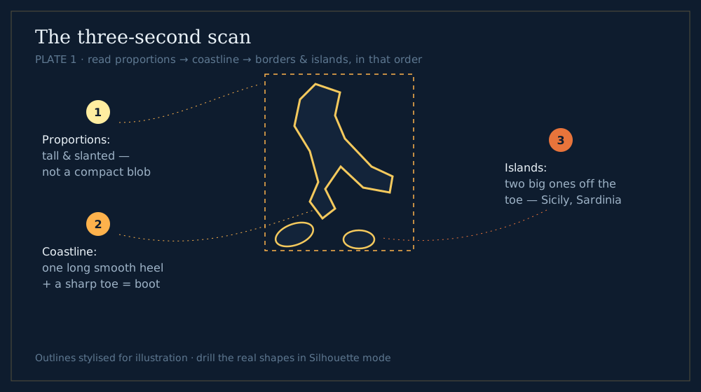 Plate 1 — the scan order: proportions → coastline → borders & islands.
Step 1 — proportions. Squint and reduce the shape to its bounding box. Is it long and thin (Chile, Norway, Vietnam), roughly round (France, Poland), or wide and flat (Mongolia, Turkey)? This single judgement typically eliminates three quarters of the field. Chile is the extreme teacher here: per the CIA World Factbook it runs about 4,300 km north to south but averages only about 180 km wide — a 24:1 shape no other country matches except by imitation.
Step 2 — coastline character. Trace the edge with your eyes. Is it smooth (Uruguay’s Atlantic sweep), gently wavy (India), or violently jagged (Norway’s fjords, Greece’s ragged Aegean edge)? Coastline texture is the fastest way to split lookalikes within a family — and thanks to what geographers call the coastline paradox, fractal coasts like Norway’s stay unmistakably “fuzzy” no matter how far you zoom out.
Step 3 — borders and islands. Finally, the details: ruler-straight edges (a story we’ll come to), a hanging peninsula, an offshore island cluster. Italy without Sicily and Sardinia is still a boot; with them, it is unambiguous. Many correct answers live entirely in this step — New Zealand is “two long islands with a strait,” and nothing else is.
💡 Pro tip: say your scan out loud when practising — “tall ribbon, jagged edge, wide top… Norway.” Verbalising forces you to actually run the steps instead of gambling on gut feeling, and the habit sticks after about twenty repetitions.
The seven shape families
Every outline you will meet in a quiz sorts into one of these seven families. Sorting is the point: once you know the family, you are choosing between three or four candidates instead of a hundred and ninety.
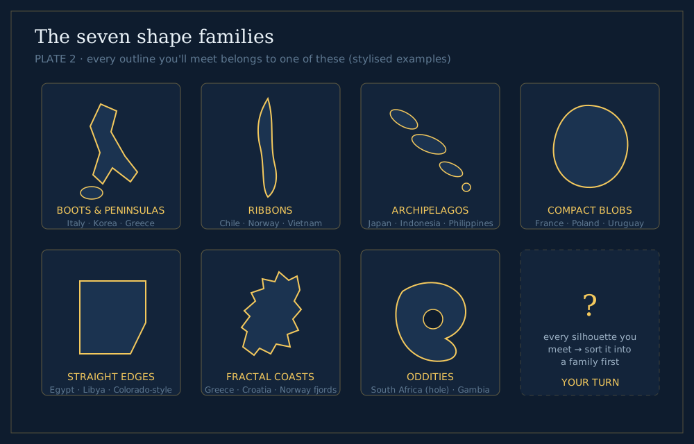 Plate 2 — the seven families. Sort first, identify second.
1. Boots and peninsulas
Land that kicks out into the sea with a recognisable limb: Italy’s boot, the Korean peninsula, Greece trailing its Peloponnese, Denmark’s Jutland thumb. The limb is the identity — focus on its direction and what dangles off it.
2. Ribbons
Absurdly elongated countries: Chile, Norway, Vietnam (an S-shaped ribbon), Panama lying on its side, Portugal as a short vertical strip. Identify by which way the ribbon runs and how it bends — Vietnam’s double curve versus Chile’s near-straight drop.
3. Archipelagos
No mainland at all, just a scatter. The three giants have distinct scatter patterns: Japan is a tight arc of four main islands; the Philippines (7,641 islands by official count) is a loose vertical spill; Indonesia (more than 17,000 islands) is a horizontal sprawl wider than the continental United States. Smaller members — the Bahamas, the Maldives — read as dotted lines.
4. Compact blobs
The hardest family, because a blob is a blob: France’s hexagon, Poland, Belarus, Uruguay, Paraguay. Here you win with step 2 and 3 of the scan — coastline texture, one distinctive bump, or a river-notch. This family fills the “almost got it” tier of every silhouette quiz, and it is where the confusable-pairs work below pays off.
5. Straight edges
Outlines with ruler lines in them. Straight borders are almost always drawn borders — lines of latitude and longitude agreed in distant capitals rather than rivers or mountains found on the ground, which is why they cluster in the Sahara, the Arabian Peninsula and North America. Egypt is nearly a square with a bite taken by the Red Sea; Libya, Algeria, Mali and Niger are polygons stitched from desert lines. A single long straight edge instantly narrows you to this family.
6. Fractal coasts
Countries whose coastline is the feature: Greece and its island swarm, Croatia’s splintered Adriatic ribbon, Norway again (it belongs to two families — that is allowed), Canada’s Arctic shatter. Fine, repeated jaggedness at card scale means fjords, skerries or drowned coastlines.
7. Oddities
Shapes with a story you only need to hear once. Lesotho is a hole — a country entirely inside South Africa. The Gambia is a riverbank drawn as a country, roughly 25–50 km wide either side of one river for hundreds of kilometres. Croatia’s crescent, Somalia’s number-7. Oddities are gifts: unforgettable after a single encounter.
The pairs everyone confuses
Most silhouette mistakes are not random — they are the same handful of within-family twins. Learn one tell per pair and the mistakes stop.
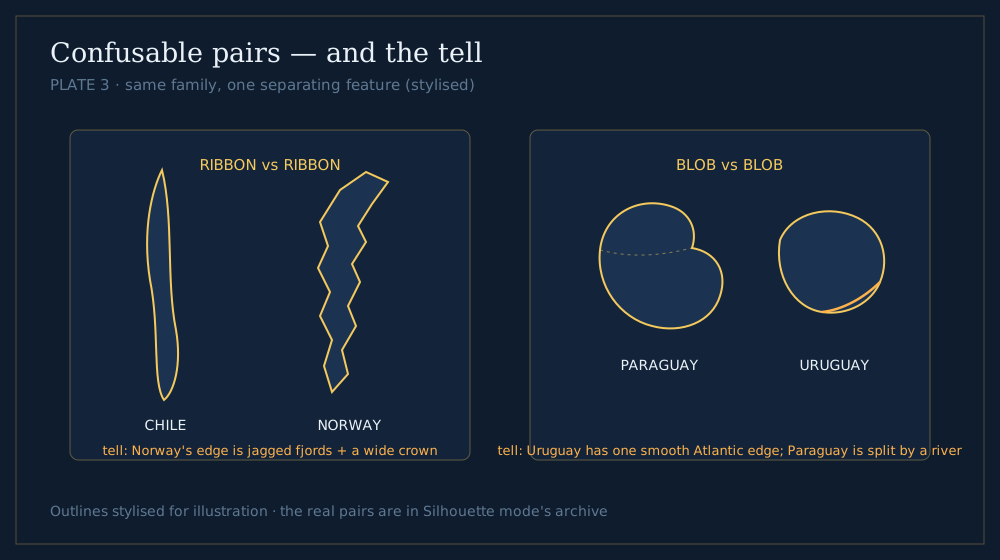 Plate 3 — same family, one separating feature.
| Pair | Family | The tell |
|---|---|---|
| Chile vs Norway | Ribbons | Norway’s edge is jagged fjords and it wears a wide “crown” at the top; Chile is smooth and even |
| Paraguay vs Uruguay | Blobs | Uruguay has one long smooth Atlantic edge; Paraguay is landlocked and pinched into two lobes by rivers |
| Belgium vs the Netherlands | Blobs | The Netherlands is taller with a hooked north-west coast; Belgium is a squat wedge |
| Guinea vs Guinea-Bissau | Blobs | Guinea is a large inward-curling comma; Guinea-Bissau is small with a shredded, islanded coast |
| Ireland vs Iceland | Blobs/Fractal | Iceland’s edge is fjord-torn with a peninsula reaching north-west; Ireland is smoother and rounder |
| Australia vs mainland USA | Anchors | The USA is interrupted by the Great Lakes’ notch and Florida; Australia has the Gulf of Carpentaria bite in the north |
| Sweden vs Finland | Ribbons | Sweden bulges west and tapers south; Finland is straighter-sided with a lake-riddled interior and flat southern coast |
📝 Note: when two candidates survive your scan, do not stare harder — look away from the shape and ask a knowledge question instead: “is this country landlocked?” A silhouette with no smooth sea-edge anywhere is landlocked, and that single fact separates Paraguay from Uruguay, Bolivia from Peru, and half the blob family.
Ten unmistakable outlines to learn tonight
Momentum matters more than method on day one, so start with shapes that pay off immediately. These ten are so distinctive that one honest look each is usually enough — and together they cover every family:
- Italy — the boot, mid-kick, with Sicily at its toe. The world’s most famous outline.
- Chile — a 4,300-km ribbon down a continent’s edge; nothing else is remotely as thin.
- Japan — a tight, elegant arc of four islands leaning north-east.
- India — a bold triangle hanging from the Himalayas, with Sri Lanka’s teardrop below.
- Australia — the unmistakable continent-blob with the Gulf of Carpentaria bitten from its northern edge.
- Norway — a fjord-shredded ribbon wearing a wide Arctic crown.
- Egypt — the near-square with a Red Sea bite and the Sinai triangle in the corner.
- Indonesia — an island sprawl wider than the continental USA, instantly not-Japan.
- The Gambia — a wriggling riverbank of a country, swallowed inside Senegal.
- South Africa — the continent’s rounded foot with the Lesotho hole punched in it.
Each of these is also an anchor in the mapping sense: once you own them, dozens of neighbours become “the shape north of India” or “the blob inside South Africa’s curve.” That is how the catalogue compounds — every learned shape makes the next one cheaper.
📖 Further reading: shape memory pairs beautifully with flag memory, because both run on single distinguishing features. Our flags that look alike guide applies the same one-tell method to the other half of the quiz world.
The four-week drill plan
Recognition is built by retrieval, not by staring at labelled maps. Ten focused minutes a day for four weeks is enough for most players to go from “anchors only” to naming most of the world.
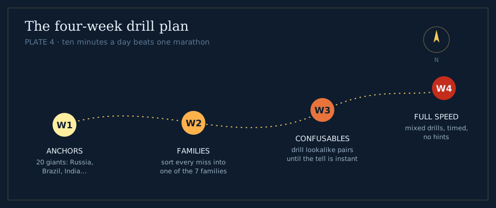 Plate 4 — ten minutes a day beats one marathon.
Week 1 — anchors. Drill the twenty giants until they are instant: Russia, Canada, China, the USA, Brazil, Australia, India, Argentina, Kazakhstan, Algeria and their tier. These become your reference frames — everything else is “near Brazil” or “smaller than India.”
Week 2 — families. Play daily rounds in Silhouette mode and sort every shape you miss into one of the seven families before reading the answer. The sorting habit is the skill; the names attach themselves surprisingly quickly once the family is right.
Week 3 — confusables. Work the table above plus every pair you personally confused in weeks 1–2. Look the two shapes up side by side, pick one tell, say it out loud. One tell per pair is enough; three tells per pair is how you forget all of them.
Week 4 — full speed. Mixed, timed drills with no hints. Miss a shape twice and it goes on your personal confusables list for a week-3-style review. From here, maintenance is just playing: a daily silhouette plus a round of Globle keeps the whole catalogue warm — the two skills reinforce each other, since map position and shape are stored together.
If you want a companion challenge while the catalogue builds, our hardest countries to guess list overlaps heavily with the blob family, and the geography games roundup has more shape-based games to cross-train in — plus States mode to run the same method on US state outlines, where straight edges rule and Colorado is the family mascot.
Bonus round: the same method on US states
Everything above transfers to state outlines — and States mode is the perfect second gym, because US states exaggerate the families. The straight-edge family dominates utterly: Colorado and Wyoming are pure rectangles (the only two), Kansas and North Dakota miss by one wavy river edge, and the entire west reads as surveyors’ geometry. The oddities are world-class: Michigan is two peninsulas shaped like a mitten and its glove, Florida is a panhandle plus a peninsula nothing else resembles, Maryland looks like it was torn in half by the Chesapeake, and Alaska’s fractal-coast sprawl would lead the family on any continent.
The scan order shrinks to two steps out west — proportions, then which edges wiggle — and returns to the full three in the east, where colonial-era rivers did the drawing. Ten minutes of state drills also sharpens world-outline skills noticeably: rectangles teach you to notice straight edges, and noticing is most of the scan.
Frequently asked questions
What is the easiest country to recognize by outline?
Italy is the usual answer: its boot shape, complete with a Sicilian "football" at the toe, has been a visual cliché for centuries. Australia, India's triangle, and Chile's 4,300-km ribbon are close behind. These four make excellent anchors for a beginner's reference frame.
What are the hardest country outlines to guess?
Compact landlocked blobs with no coastline features: Belarus, Moldova, Paraguay, Burkina Faso, Zambia. With no sea edge and no dramatic limbs, they offer the scan almost nothing — which is why the knowledge question "is it landlocked?" and neighbour-elimination matter more than staring.
Why do so many African countries have straight-line borders?
Because many were drawn as lines of latitude and longitude by colonial powers — most famously formalised after the 1884–85 Berlin Conference — rather than following rivers or mountain ranges. For quiz purposes the history has a practical upside: a long ruler-straight edge immediately places an outline in the Sahara/Sahel belt or the Arabian Peninsula.
How long does it take to learn all country shapes?
With ten minutes of daily retrieval practice, most players recognise the majority of the world's outlines within about four weeks, anchored by the twenty giant countries learned in week one. The long tail — small Pacific and Caribbean island states — takes longer and is best learned as archipelago patterns rather than one-by-one.
Does outline practice actually help in Globle?
Directly. Globle rewards knowing where countries sit relative to their neighbours, and shape memory and position memory are stored together — you remember Paraguay's two-lobed blob *between Argentina, Bolivia and Brazil*. Players who drill silhouettes consistently report faster endgames, because the final "which neighbour is it?" step stops requiring a mental atlas search.
We build and maintain the seven geography games on this site, including Silhouette mode and the country dataset the drills above are based on. Spotted an outline pair we should add to the confusables table? Tell us.